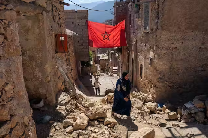
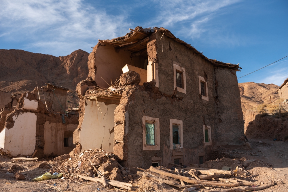
Late one night in September, a shallow earthquake struck the Atlas Mountains in western Morocco. The US Geological Survey said the quake had a magnitude of 6.8 with an epicenter some 72 kilometers (45 miles) southwest of Marrakech, the North African country’s fourth-largest city. When it struck across six provinces that night, the earthquake affected an area larger than Switzerland.
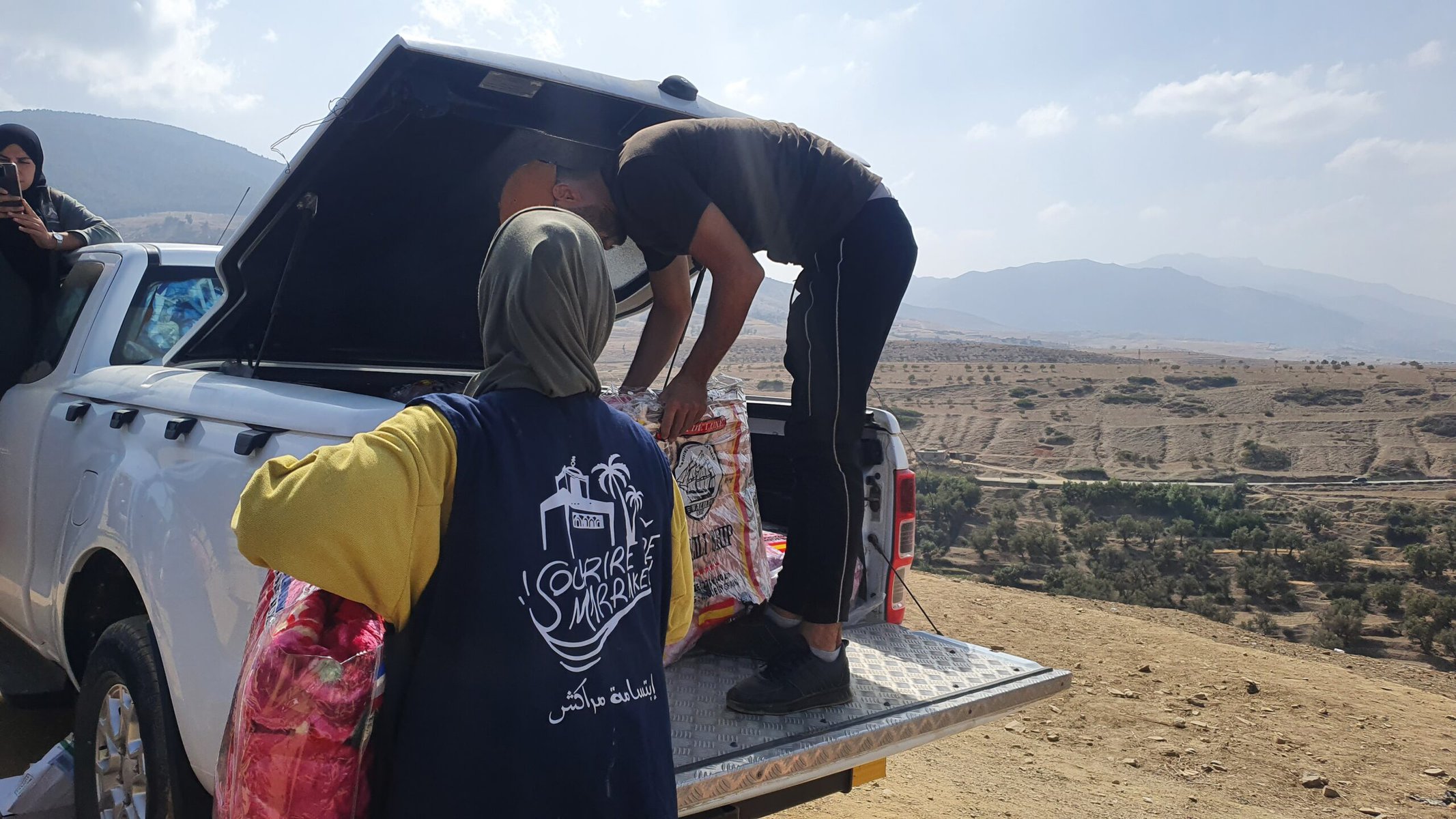
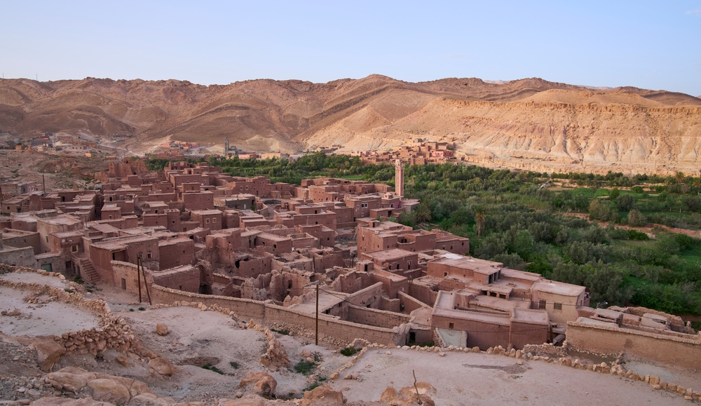
The worst-hit locations were literally off the map — rural mountainous villages unfamiliar to most Moroccan citizens, let alone relief workers from foreign countries. Within hours, humanitarian aid organizations, both local and international, shifted into high gear. But the caravans, carrying basic necessities and journalists eager to tell the story, faced a hurdle: finding out where to go and how to get there.
“The post-earthquake crisis reminded me of the early days of Coronavirus, with immense confusion and absence of crucial information,” says Moroccan topographer Nabil Boutrik. “It was in 2020 that I had built my first online database to publish accurate information about the number of fatalities and infections, and to counter rumors and misinformation infesting social media platforms. Right after the earthquake, I felt the need for another database to make important information available.”
The earthquake, which was the strongest to hit the country in 60 years, killed over 2,900 people, injured about 3,000 others and left many more homeless. According to Moroccan local authorities, 2,930 villages — one-third of the villages in the High Atlas Mountains region — were either completely or partially destroyed.
Despite the wide-scale devastation, the Moroccan government was adamant that relief efforts be led by local workers. In an attempt to avoid geopolitical conflict and make sure that donations were used efficiently, Morocco made the controversial decision to only accept a fraction of the international aid offered. Seisme Maroc Data, the online database Boutrik created for the difficult-to-access regions, contributed to streamlining efforts and resources.
“I decided to build a bilingual [Arabic-French] interactive online database providing information about and geo-mapping the disaster-stricken areas within a 50-kilometer radius,” says Boutrik.
Within days, the database was live, and over the following weeks, it compiled information on 123 regions, including hundreds of villages as well as 54 relief organizations, providing users with updated information on road conditions and other details crucial for coordinating relief and rescue missions.
Connecting the dots
Like everyone else, Boutrik was shocked at the destruction that befell his country in a matter of seconds and the horrifying loss of lives.
“I feared for my in-laws who live in Aghadir, near the epicenter,” the 39-year-old says.
Hailing from the coastal city of Nador, the provincial capital of the northeastern Rif region of Morocco, Boutrik is no stranger to temblors: his city lies 125 kilometers south of Al Hoceima, the site of a 6.3 magnitude earthquake that claimed over 600 lives and left some 15,000 people homeless in 2004.
So with his deep knowledge of the topography of the quake-hit mountain areas, and familiarity with the state of panic such natural disasters create, Boutrik was compelled to act in the most effective way he could.
Crushed by negative news?
Sign up for the Reasons to be Cheerful newsletter.With the help of his collaborator Yassine Chamkh, a 23-year-old computer engineering student, who was responsible for the technical aspects of the initiative, he used topographic maps and high-resolution satellite imagery to pinpoint the affected communities and small villages.
He then used this data to build the easy-to-navigate interface, consisting of several spreadsheets and an interactive Google map. The first sheet includes the names and whereabouts of all the afflicted areas and villages, a contact person in each location, their telephone numbers, and details about the survivors such as the number of children and number of people injured.
The second sheet is a table of requests, listing the names and contact information of relief organizations, the area they serve and the type of assistance required. Users only need to fill out a simple online form to add a new village and their specific assistance request. The site administrators then add the information to the two regularly-updated spreadsheets.
The site has had over one million visitors to date, according to Boutrik.
Since 88.1 percent of Morocco’s population has internet access, including via mobile phone, the platform was adopted quickly, even in remote regions.
The right help
The continuous updates to the database were instrumental to its success, according to those who used it.
Omar El-Malouli is a resident of Zawyat Al-Farfar district, located in Ida Ougoummad village in the Taroudant region, which reported 980 deaths. All 300 residents of El-Malouli’s village survived the earthquake, which was not the case in neighboring villages. But all 70 homes were destroyed.
But El-Malouli says the platform made a difference. “The village was in dire need of basic necessities like tents, food and blankets. The platform helped make sure that our exact needs were met,” he explains.
Sofia Ait M’barek, the president of the Marrakech-based Smile Association, says that although her organization was active in the region prior to the disaster, the platform helped increase its efficiency.
“After distributing aid to some of the affected villages in the Al Hoceima region, we registered on the platform to avoid redundancy with other charitable organizations,” says M’barek.
Soon after transporting food, bedding and clothing, she realized that as the temperatures dropped, there were other more pressing needs, like tents. “We communicated this through the platform to encourage other organizations to donate items we did not have,” she says.
About 80 kilometers from Marrakech, in the village of Tolkin, which was totally destroyed, survivor Hassan recounts a similar situation.
“I saw on the platform that a charitable organization was about to deliver a large quantity of milk to my village, but what we needed were blankets. I contacted them through the platform, so they brought us the blankets and sent the milk to another place where it was more needed,” he says.
The platform’s efficiency also helped reduce waste. “It gave donors information about the exact needs of each village, so the surplus would be diverted to other areas in dire need,” Boutrik explains.
A key resource
According to Anass Aktaou, who covered the earthquake for local news outlet Febrayer, charitable organizations were “the ones who benefitted the most from this platform, as they were able to precisely identify the locations and needs of each village.”
“Initiatives like this one address one of the toughest challenges faced by rescuers and volunteers, that is, making information readily available and facilitating cooperation between various entities,” says Younes Ezzouhir, a Moroccan journalist with local news site al3omk.com.
“Rugged and unfamiliar terrain, known only to the local population, was a challenge for journalists, rescuers and volunteers. The platform helped save lives as it sped up the evacuation, rescue and shelter operations,” Ezzouhir adds.
According to a member of the Moroccan civilian defense in Al Houze region, where 1,680 people were killed, the initiative helped reduce the number of vehicles carrying aid to the villages, hence speeding up the delivery and streamlining donations.
“The roads were so congested, and rescue teams struggled to reach some of the villages,” he says. (He asked to remain anonymous, as he was not authorized to speak to the press.)
A Spanish relief worker in Amizmiz, where international rescue teams from Spain, Britain and Qatar were stationed, agreed that the platform had a huge impact on the speed of operations.
“This kind of work is essential during natural disasters, not only in Morocco but worldwide,” he said. “When we first arrived, the narrow unpaved roads were packed with cars eager to help from all over the country. This individual initiative saved time and helped us rescue more people.”
According to Boutrik, right after the earthquake struck, a charity called Nt3awnou (“we collaborate” in Arabic) used its own online platform to coordinate the delivery of essential needs between NGOs and earthquake victims. But the effort was too localized and did not help the worst-hit remote villages. “The platform I built expanded this idea to cover a wider region and to geolocate the unknown villages,” says Boutrik. “But anyone on earth can replicate this online database if they have enough knowledge of the topography of the region they wish to cover and if they have the necessary technical skills.”
Two months after the quake, traffic on the platform has slowed, but it will remain available as a reference, says Chamkh: “Even though the emergency response is over and the platform will no longer be updated, the site will remain live and the data will always be available for the public as documentation.”
The article was published in collaboration with Egab.