When the Waal River floods near the Netherlands’ border with Germany, the overflow inundates the Millingerwaard nature reserve, swamping meadows, glades and trails. Beavers move up into the trees and build temporary homes. The current reshapes the landscape, eroding gullies and leaving new ponds in its wake.
This isn’t disaster. It’s design.
The low-lying Netherlands is a global pioneer in protecting against rising sea levels and oceanic storm surge, having erected massive retractable barriers off its coasts. Less well known is the country’s innovative strategies to deal with river flooding. Rather than just building up fortifications against high waters, the Dutch have made more room for floods to rush in. Millingerwaard is just one example of dozens of riverside locations across the Netherlands that have been reconfigured to make way for the inevitability of flooding.
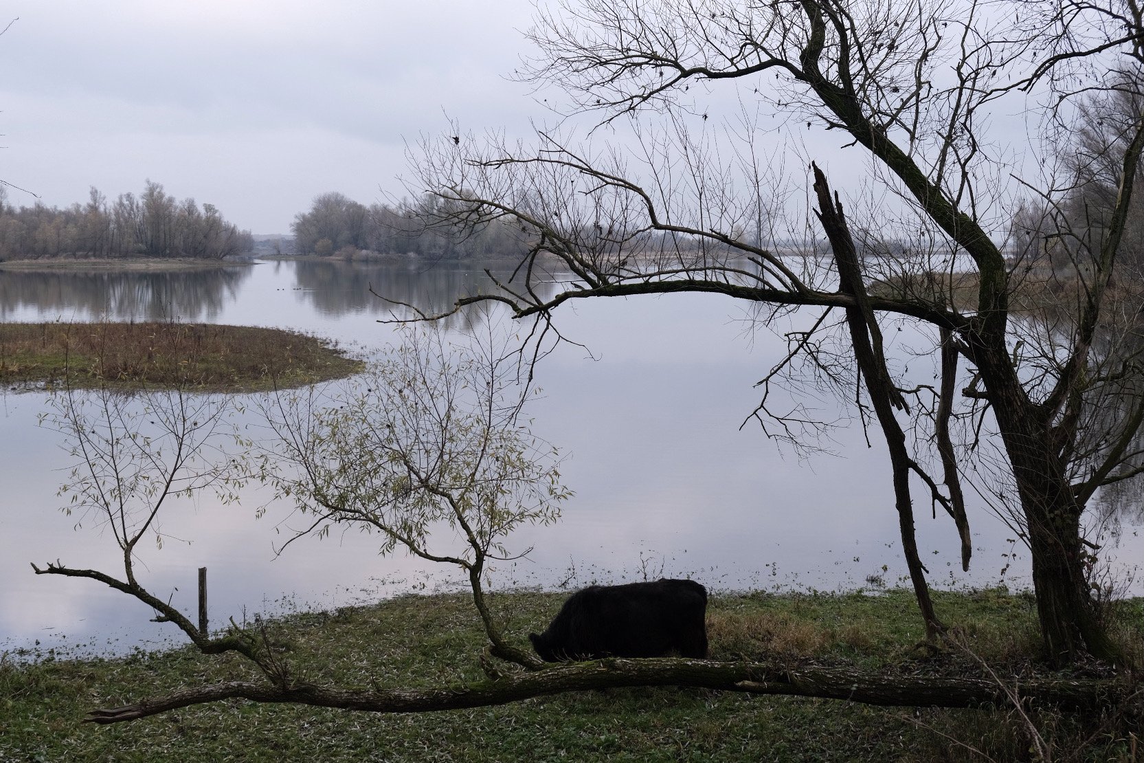
Projects like these are designed not only to mitigate damage from flooding along the river, but to yield other advantages that actually benefit the surrounding environment. Adjacent to the busy shipping route on the Waal, Millingerwaard is a celebrated example of floodplain ecological recovery. And in the nearby city of Nijmegen, an initially controversial second channel created a park that has remade the city’s relationship with the river.
Coastal destruction is a dramatic visual symbol of our warming planet. But climate change is making river flooding more common, too. Rising temperatures mean the atmosphere can hold more moisture, leading to intense rainfall, prompting floods like the deadly ones in Germany in 2021.
For centuries, the Dutch protected against river overflows by building up dikes. Despite these measures, major floods in 1993 and 1995 prompted evacuations of a quarter-million people.
“That was actually the beginning of reconsidering how to deal with larger floods on rivers,” says Frans Klijn, a water management expert with the research institute Deltares. “Are we going to raise the embankments more and more and more, ever again and again and again? Or do we need to change our policy?”
In the early 2000s, the Netherlands chose the latter when it launched the Room for the River program, which transformed the country’s approach to river flooding from “wall it in” to “let it flow.” Alongside flood safety measures, which included expanding floodplains and removing bottlenecks, the program’s projects incorporated nature, recreation or industry. While the national government was the architect of the strategy, local governments and stakeholders realized the projects.
The multi-functional approach was key, explains Klijn, who served on an oversight committee for the program, because large floods happen rarely, but people interact with the spaces daily.
“If you make something ugly, which functions once every thousand years, but looks ugly every day, then you’re doing a stupid thing,” Klijn says. “What you need to do is have a secondary objective, which is enhance the quality of the environment.”
Frans Schepers watches ripples on the placid small pond in the early dusk of a December afternoon. A duck. Not a beaver.
“Sometimes you just see them,” whispers Schepers, a longtime frequenter of Millingerwaard and the co-founder of Rewilding Europe, an organization working with local partners to create new wild nature areas across the continent. Native to the Netherlands but extinct since the 1800s, beavers were among the first species introduced after the former farmland was transformed into natural habitat in the 1990s.
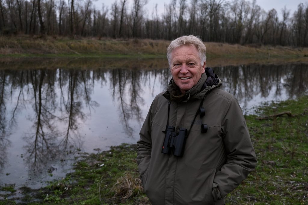
Surefooted on the carpet of damp oak and willow leaves, Schepers deftly hops over a two-foot-wide channel the semi-aquatic rodents built connecting ponds in the riparian forest. The fresh scent of water mint wafted from hearty green sprigs growing from the marshy earth, but was overtaken by a muskiness — a trace of a fox. Though the beavers remained hidden, their presence was obvious from their dens and teeth marks on tree trunks.
The Rhine River that flows all the way from the Alps enters the Netherlands here, splitting into multiple branches, including the Waal. The river had once naturally shifted its path over a large plain, but its course was restricted over centuries. Land was converted for agriculture, a transformation that intensified after World War II.
Natural spaces adjacent to the river diminished, and dikes were built up to protect farmland from flooding. But the river’s narrower course came with risks, like when early snowmelt and heavy rains upstream swelled rivers in January 1995. This area was one of those evacuated as high waters threatened to breach the dikes. The embankments held, but the event was a wake-up call that made locals more open to the idea of leaving space adjacent to the river.
The Millingerwaard reserve emerged from a coalition of interests including nature development, flood protection and the local economy — both the clay-mining industry and new nature tourism.
“It was a win-win-win situation,” says Bart Beekers, of ARK Nature. The organization launched the Millingerwaard project in 1991 with a section of sandy riverside dune that had been used to graze sheep. The area grew as organizers acquired a patchwork of adjacent lots, restoring natural processes to the floodplain partially encircled by the meandering Waal River.
From the downstream side, clay mining companies dug out a series of channels. Now, when the river runs high, water fills up the side channels. If the river is very high, it inundates the whole area — lessening the force of floodwaters downstream. The changes decreased the river level by nine centimeters.
Fuzzy Galloway cattle and konik horses graze vegetation freely, creating a mosaic of ecosystems in the landscape. Goosanders, migrated south for winter, swoop among other birds over the glassy reservoir. A smokestack of a factory that turned clay dredged from the new channels into bricks protrudes over the trees.
Collaboration with industry, like clay and sand extraction companies in Millingerwaard, is often an important element when rewilding new places, according to Schepers.
“Who would dig such a channel if it would just cost money? Nobody would pay for that, right?” he said, gesturing out across the water. “If you link up with these forces, economic forces, and they do things in a different way, you can achieve a lot.”
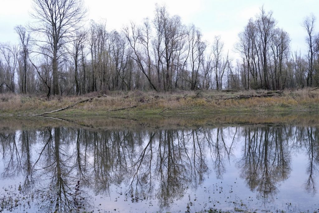
Farming had left little room for nature along Dutch rivers, and biodiversity had declined. Allowing natural processes to take over has ushered in a range of species. An informal tally by local wildlife enthusiasts recorded more than 5,000 plant and animal species in 2022 in the whole Gelderse Poort, the nature area encompassing Millingerward. Flooding is a part of the ecosystem, dropping seeds and shifting the earth, leaving pools prime for insects and amphibians.
Though some 30 agricultural jobs were lost with the creation of Gelderse Poort, more than 200 jobs were created as the area has become a tourist attraction, generating new restaurant and hospitality businesses.
Millingerward is an early example of the pairing of rewilding and flood safety now guiding many other projects, nearby in the Netherlands, and across Europe.
“I think that’s what this shows, is that nature is our best ally in solving some of these big challenges we have,” Schepers said. “Climate resilience, but also socio-economic benefits.”
About 10 miles downstream, the Waal takes a sharp turn. The river has made this a strategic spot for millennia. Romans established one of the northernmost posts of their empire here; Charlemagne built a palace.
But for the modern city of Nijmegen, the river created a risky situation.
While the riverbed was more than a mile wide upstream, it narrowed to roughly a quarter-mile between the city center to the south and a dike protecting the village of Lent to the north. With the right-angle turn, low-lying parts of the historic city were vulnerable to flooding — as in 1995 when the Waal overran the waterfront, though impacts were not as severe as feared.
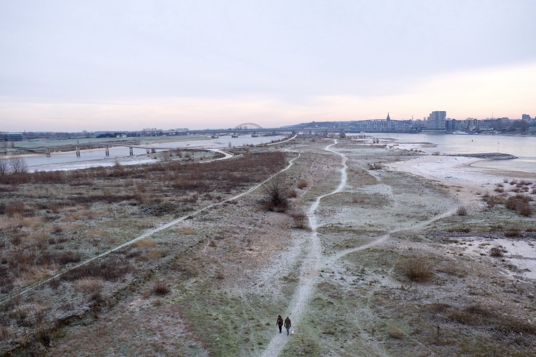
To address the bottleneck, a secondary channel was created parallel to the river on the northern side, creating a long island between the two that has become a popular park.
Changing the riverbed took years of negotiation and planning, recalls Andrea Voskens, who worked as a stakeholder manager for the municipality during the project. The idea of making room for the river was a significant shift of mindset, she explains.
“You want to fight, keep it out,” she says. “And that’s not working. It’s not sustainable.”
Weighed down by negative news?
Our smart, bright, weekly newsletter is the uplift you’ve been looking for.To build the new side channel, the municipality, on behalf of the national Rijkswaterstaat, had to buy and demolish 50 houses. Initially, the proposal was met with resistance, according to Voskens. Residents proposed an alternate solution, taking it all the way to the Dutch Parliament. After lawmakers opted for the original, households agreed to relocate through negotiations, including financial compensation or land. Though a legal process existed to force residents to move, it was not needed for any of the 50 households, according to Voskens. She credits this to an open, collaborative process, and common understanding that the expected increase in water in the Waal made the current situation dangerous.
“We all acknowledged the fact that there is a big risk and that we have to do something about it,” she says.
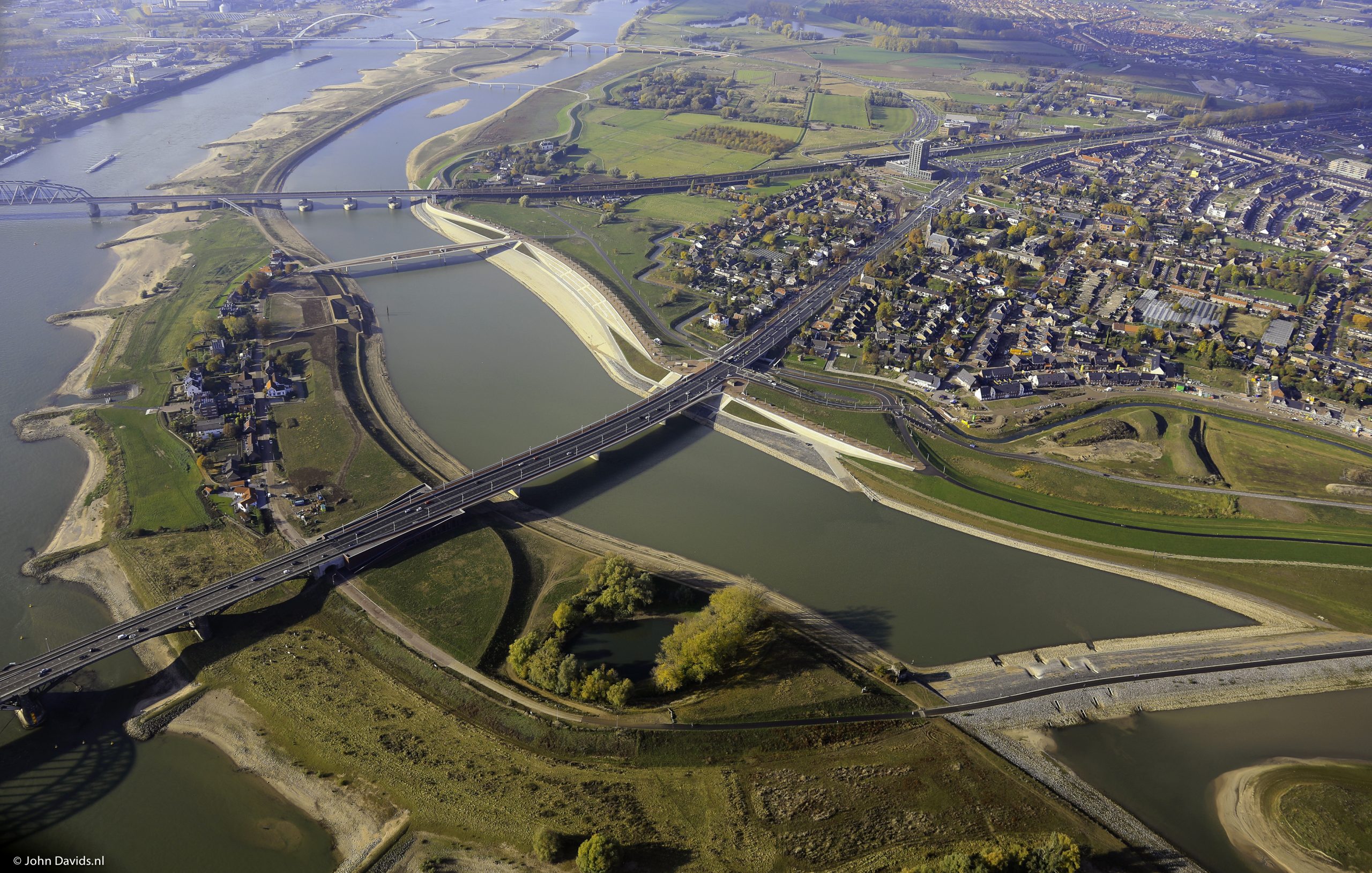
The project lowered the water level by 35 centimeters — 8 centimeters more than its original goal, according to Rijkswaterstaat.
The city originally planned to build housing on the island, but plans stalled after it was completed and locals embraced it as a park.
Voskens says the project changed Nijmegen’s relationship with the river. With its dangerous currents and busy shipping traffic, the Waal had been useless for recreation.
Now, runners and walkers frequent footpaths through the island’s shrubby vegetation. In warm weather, the island hosts festivals. Rowers and swimmers paddle the calm waters of the manmade channel.
“Something happened in the dynamic of the city,” Voskens says.
Margo van den Brink, associate professor of planning and water at University of Groningen, says one of the national Room for the River initiative’s biggest successes is the combination of flood safety with spatial quality. Most of the initiative’s 34 projects not only addressed high waters, they made riverine areas more livable, aesthetic or sustainable. That dual purpose is especially important in light of climate change.
“It is really a key example of this more spatial approach to flood risk management, which is so needed now,” she says.
The program shows how including spatial designers, like landscape architects, in river management projects can help unite multiple ambitions.
Klijn, who sat on the committee that oversaw the spatial quality of projects, says strong central leadership was key to the program’s success. While local involvement of residents and stakeholders is important, people must understand what is negotiable and what is not. A planning kit was developed to select Room for the River projects, involving leaders and local stakeholders — a process that helped communicate why it was necessary to make changes in certain specific locations. Together, the projects lowered the flood level along all the branches of the Rhine in the Netherlands, including the Waal.
The full flood capacity of the Room for the River project has not yet been tested. But in 2018, high waters on the Rhine’s branches discharged without issue, according to Rijkswaterstaat. Related projects along the Maas River in the southern part of the Netherlands seemed to blunt the 2021 floods.
Still, the Dutch are continuing to build flood capacity as climate change is expected to produce higher water levels in future.
When traveling around the country, Klijn says he notices how the areas around waterways have changed.
“There’s much more room for nature, and we see much more biodiversity.”


